Worker Inflow/Outflow
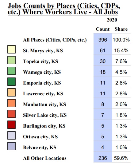
The following chart from the U.S. Census Bureau’s OnTheMap Application provides insight on how many workers reside in the Emmett Township. OnTheMap also provides a full Emmett Township Inflow/Outflow Report.
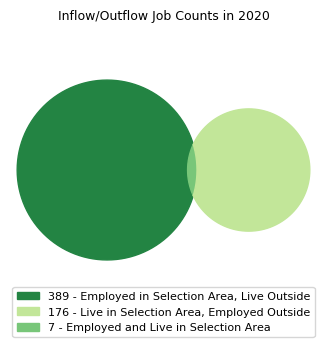
Source: U.S. Census Bureau OnTheMap Application
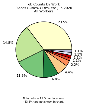
Source: U.S. Census Bureau OnTheMap Application