Census Tract 4
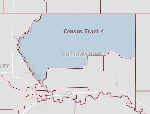
Geographically, census tract 4 is the largest in Pottawatomie County, covering a great deal of the northern half of the county, including the communities of Olsburg, Westmoreland, Wheaton, Onaga, and Havensville, and the surrounding rural areas.
The following data, sourced from the U.S. Census Bureau, gives an overview of the demographics of tract 4:
| Pottawatomie County, KS, Census Tract 4 Overview | |
| Population | 4,142 |
| Median Age | 50.7 |
| % 65 Years and Older | 25.1% |
| % Veterans | 8.8% |
| Total Households | 1,587 |
| Median Household Income | $64,356 |
| Homeownership rate | 75.6% |
| Total Housing Units | 1,891 |
| Employment Rate | 55.1% |
| Average Travel Time to Work (in Minutes) | 25.7 |
| % With a Bachelor’s Degree or Higher | 30.8% |
| % Without Healthcare Coverage | 3.4% |
Census Tract 3
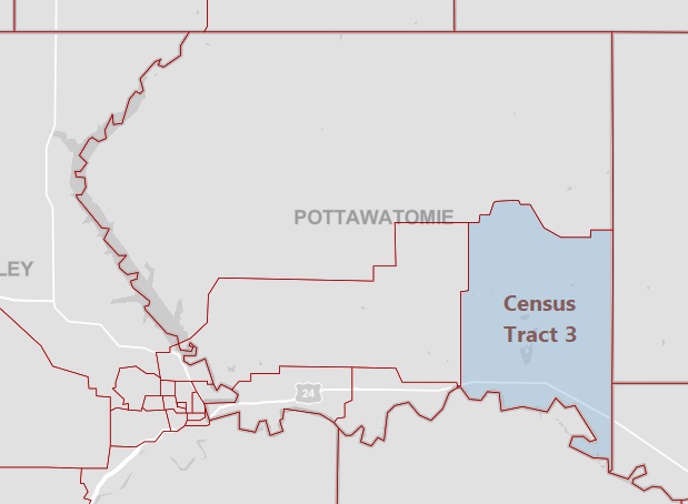
The following chart, based on data from the U.S. Census Bureau, provides additional insight on the populations included in Census Tract 3:
| Pottawatomie County, KS, Census Tract 3 Overview | |
| Population | 4,745 |
| Median Age | 26.9 |
| % 65 Years and Older | 10.2% |
| % Veterans | 6.9% |
| Total Households | 1,498 |
| Median Household Income | $66,667 |
| Homeownership rate | 79.5% |
| Total Housing Units | 1,504 |
| Employment Rate | 61.6% |
| Average Travel Time to Work (in Minutes) | 21.1 |
| % With a Bachelor’s Degree or Higher | 24.1% |
| % Without Healthcare Coverage | 6.8% |
Census Tract 1.01
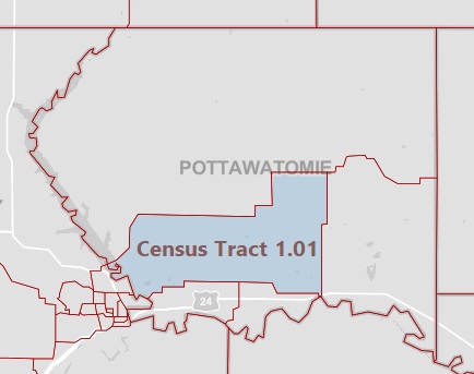
U.S. Census Bureau demographic information for Census Tract 1.01 is included below:
| Pottawatomie County, KS, Census Tract 1.01 Overview | |
| Population | 2,497 |
| Median Age | 40.9 |
| % 65 Years and Older | 12.5% |
| % Veterans | 11.6% |
| Total Households | 821 |
| Median Household Income | $82,557 |
| Total Housing Units | 1,006 |
| Employment Rate | 73.9% |
| Average Travel Time to Work (in Minutes) | 29.2 |
| % With a Bachelor’s Degree or Higher | 39.0% |
| % Without Healthcare Coverage | 6.2% |
Census Tract 1.02
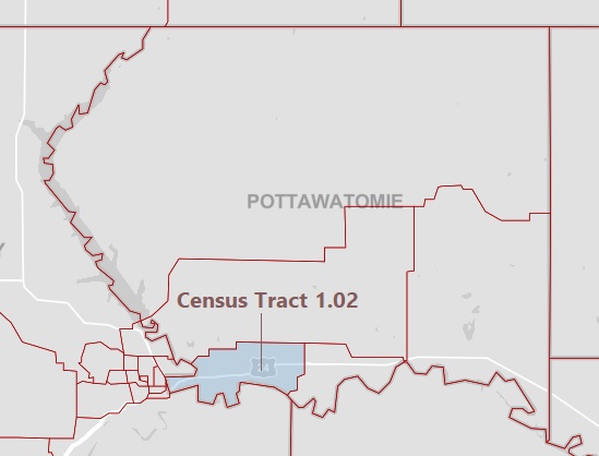
The following data from the Census Bureau provides additional insight on the populations included in Census Tract 1.02:
| Pottawatomie County, KS, Census Tract 1.02 Overview | |
| Population | 7,973 |
| Median Age | 32.2 |
| % 65 Years and Older | 12.1% |
| % Veterans | 14.4% |
| Total Households | 2,778 |
| Median Household Income | $84,667 |
| Total Housing Units | 2,961 |
| Employment Rate | 64.6% |
| Average Travel Time to Work (in Minutes) | 23.0 |
| % With a Bachelor’s Degree or Higher | 44.4% |
| % Without Healthcare Coverage | 4.5% |
Census Tract 2
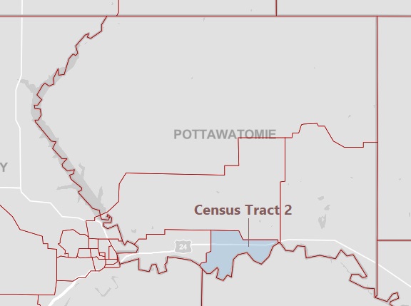
The chart below includes additional Census Bureau information on the population of Census Tract 2:
| Pottawatomie County, KS, Census Tract 2 Overview | |
| Population | 5,991 |
| Median Age | 37.4 |
| % 65 Years and Older | 14.3% |
| % Veterans | 8.7% |
| Total Households | 2,104 |
| Median Household Income | $77,679 |
| Homeownership rate | 73.8% |
| Total Housing Units | 2,504 |
| Employment Rate | 68.9% |
| Average Travel Time to Work (in Minutes) | 30.5 |
| % With a Bachelor’s Degree or Higher | 39.7% |
| % Without Healthcare Coverage | 3.0% |